

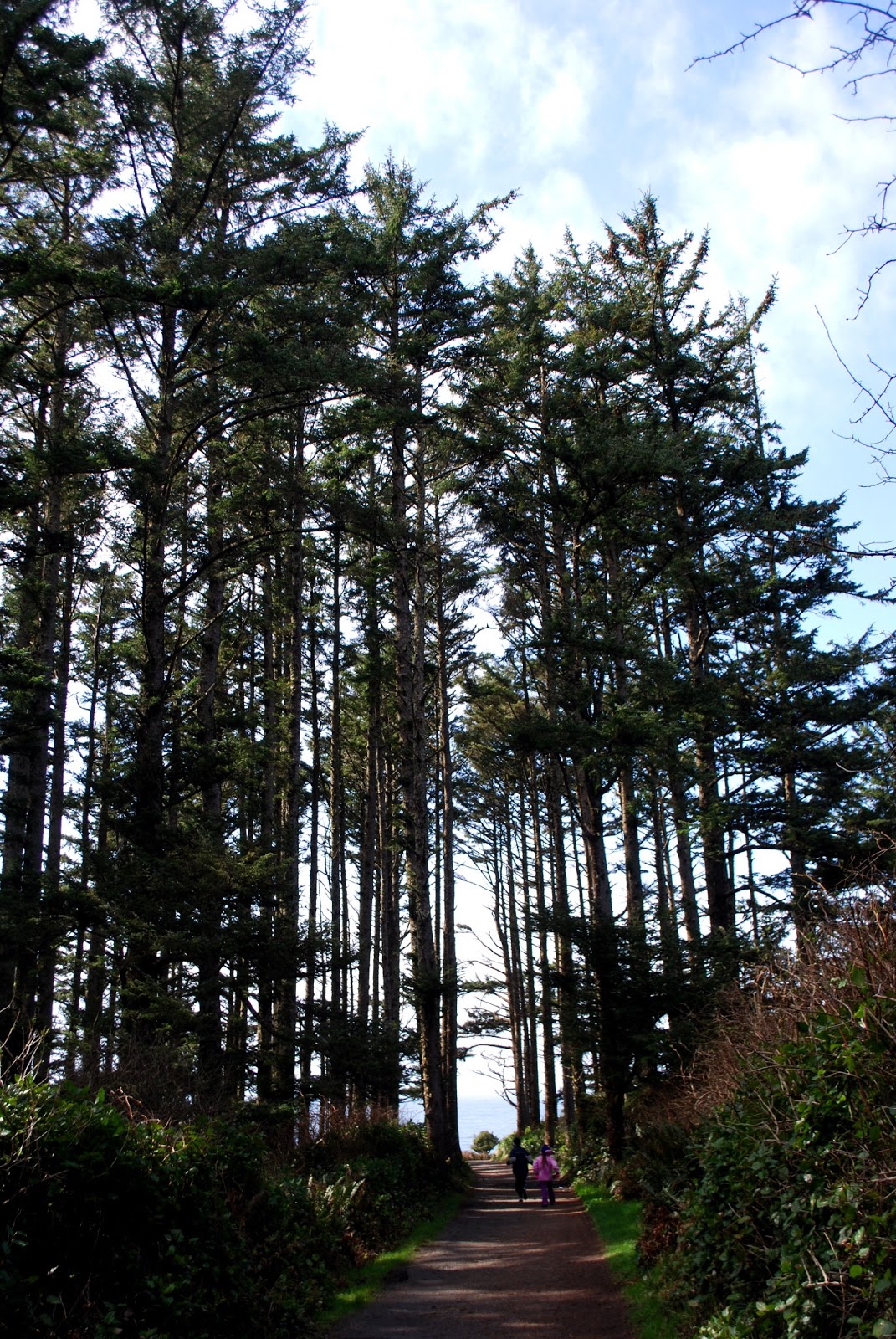
Our first stop in the park was the North Head Lighthouse. In order to get there, we had a lovely hike down a .25 mile trail.


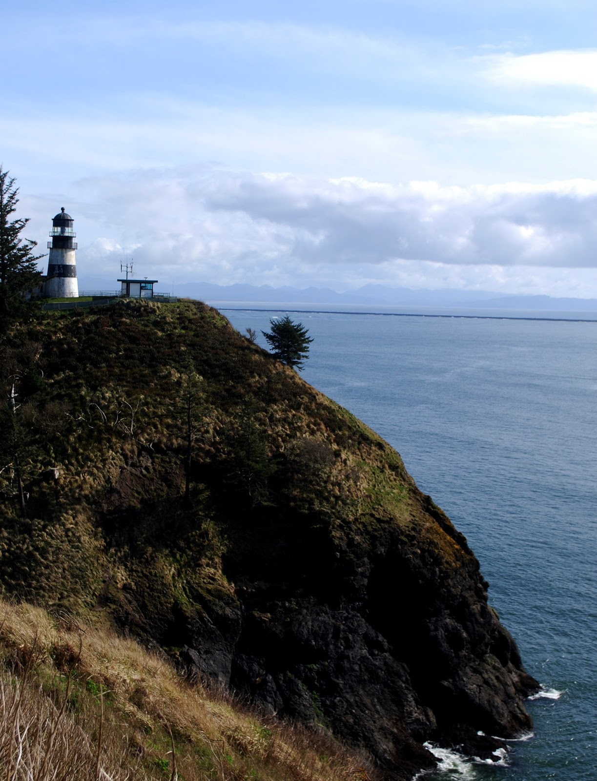
To the north was another cliff, kind of a twin to the one the lighthouse topped.

The North Head Lighthouse is still an active aid to navigation, but its keepers are long gone. The oil lantern that used to serve as its beacon has been replaced, taken over by an automated process since 1961. The keepers used to have to clean the beacon's Fresnel lens daily, polishing it with soft rags. According to a sign on the site, once every other month, they'd polish the lens with wine, to ensure it shone brightly.
Since the lighthouse was so remote, its keeper, first assistant and second assistant (all employees of the United States Lighthouse Service) and their families worked toward a self sustaining lifestyle, growing a hearty garden and raising chickens.
Man, oh, man, that was a bit of a trek. Narrow path, lots of uphill. But there was plenty of pretty scenery to appreciate along the way.
Deadman's Cove looked downright inviting.


That said, there are accounts that the name came some 20-years later, when the Lewis & Clark Expedition found no ships in the vicinity, and deemed the locale disappointing.
On Monday it was anything but!

Below is a view of the lighthouse from the east side. Fifty three feet tall, it's an imposing figure, blocking out the sun.

Some of the best views of Cape Disappointment Lighthouse come from a distance. Here it is, viewed from a beach to its west.

After the two lovely lighthouses, it was time to check out a one time point of national security - the old battlement site at Fort Canby. That was another hike, but well worth it!
As we approached the site, I assumed it was established to protect our shores during WWII. Turns out I was wrong by nearly 100 years.
It was 1862 when Cape Disappointment was armed with cannons to protect the mouth of the Columbia River. It was expanded over the years and named Fort Canby, after Gen. Edward Canby, a decorated Civil War officer who was later stationed in the Pacific Northwest and assassinated during reservation negotiations with the Modoc tribe in 1873.


Clearly, the guns are long gone, but the concrete bunkers are standing strong.Some of the steel and wood elements haven't fared as well, however.

In one of the bunkers, we spied what appeared to be some old munitions. Cool!

In a quiet spot a bit away from the abandoned lookout, we found a memorial overlooking the tranquil waters. It reminded us that the conditions can change quickly at the mouth of the Columbia.

It reads, "Please take a moment to remember all those loved ones lost or buried at sea, especially the happy times you had together." It's from the family of Robert Douglas Hughes, who lived just six days beyond his 24th birthday, based on the years on the marker.
From the Fort, we went back down the hill and drove around the park a bit. We found a couple of points of interest related to Lewis and Clark and the Corps of Discovery. Like this one. ...

The type at the bottom of the plaque reads, "So wrote Capt. William Clark, as he, York, and ten men reach the Pacific in the vicinity of McKenzie Head. Always observing, Clark recorded a sketch of a flounder and nearby they established their first ocean campsite.
Very nearby, there was a granite monument. It had another of Clark's journal entries, this one from Nov. 18 of 1805. It read, "I set out with 10 men and my man York to the ocian by land ... (later in the day) I found Capt. Lewis' name on a tree. I also engraved my name ... I crossed the neck of land low and 1/2 of a mile wide to the main ocian, at the foot of a high open hill ... I assended (sic) this hill which is covered with high corse (sic) grass, descended to the N. of it and camped."

The marker says the site they camped at is believed to be within a few hundred feet of the campground. We likely tramped right over and through it.
With all of the hiking we'd done that day, I couldn't help but smile when I saw this sign.

What a great travelogue. And the photos are wonderful. Lots of history, too. How does Fort Canby compare to Fort Worden. You'll have to hit Fort Nisqually some day on your way to or from Vancouver WA.
ReplyDeletep.s. That was a heck of a lot of hiking.