EAGLE-EYED: Another beautiful May day in Seattle. After art, math and science classes up north, we returned home, gathered up the dogs and scooters and set out for some exercise and sight seeing. Boy, did we get both.
We parked out on Magnolia Bluff, the south end of our neighborhood. It offers a 180-degree view of Elliot Bay/Puget Sound. Below, you can barely see CJ, in black, on his scooter, on the sidewalk between some mansions on the north and the water on the south.
The water was so smooth this afternoon, it would have been lovely to have been bobbing about on it in a watercraft.
We descended a few dozen stairs from the top of the bluff to a narrow road, Perkins Lane. We meandered along that pretty little road until we reached a new, small park that is well off the beaten path. It's name - "W. McGraw Street End project" isn't very inspiring, but the space itself is amazing!
It was low tide, so we did some beach combing, spotting hundreds of shells and the spurts of clams under the sand. The beach has one enormous boulder. As I sized it up, I noticed an eagle perched atop!
We made our way closer to the rock - and the bird! He didn't seem to mind.
He was a BIIIIG bird. I've seen a few eagles in my time, and this was the biggest one I've ever seen.
Maybe he likes this perch because he thinks he's number one!
We marveled over the pointiness of his beak.
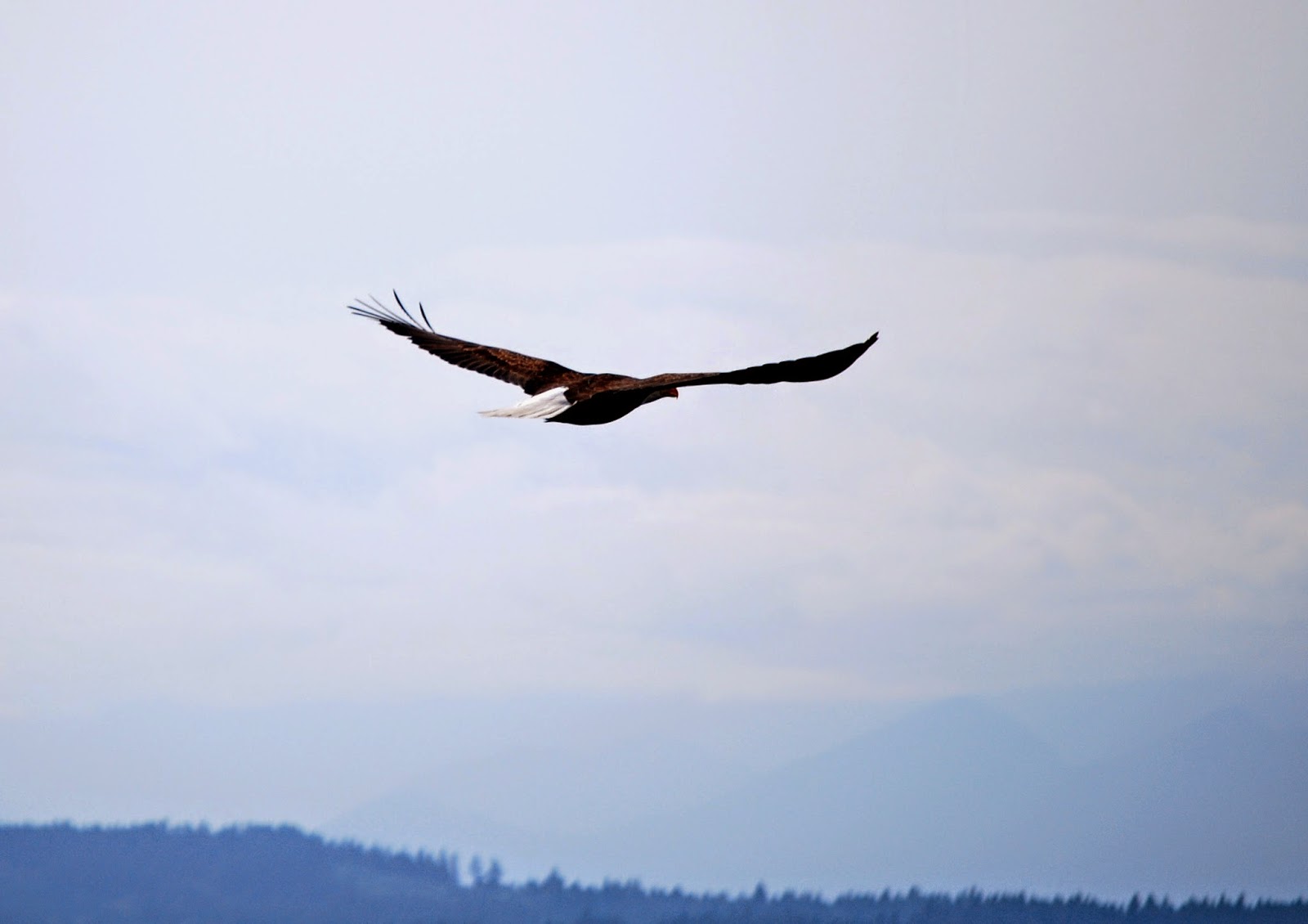
Of course, he just *had* to take off when I was changing lenses. I did manage to get him winging away.
What a wingspan!
So glad we decided to hit that park this afternoon! Well, that is, until we hit the steps leading back up to the bluff.
They were so long, you couldn't even see the top. It was a tougher climb than the Statue of Liberty, for sure.
Side note: when trying to find out of the W. McGraw Street End park had any other name, I came across
a file on the city of Seattle Web site full of info about other street end parks. From it, I learned that 149 Seattle streets end on waterfronts, and that these street ends have been designated by the city as special rights of way, to be preserved and developed for public use. Now that, IMHO, is wonderful land use planning.
The file (a PDF -
http://www.seattle.gov/transportation/docs/shoreline%20fact%20sheet.pdf) I found today actually includes a list of each and every one of those street ends. What a great resource!
JUST FOR FUN: It was 'favorite fictional character day' where the kids take classes on Wednesday. CJ donned his Rainbow Dash hoody for the occasion. He sat next to Sonic the Hedgehog during science class. :)


Beautiful eagle photos. The info about the street end parks was fascinating.
ReplyDeleteWas that a high tide line on the big rock? If so, you have a natural science study for MPA
We'll definitely be back to that spot to check out the tide lines, etc.
DeleteWow - what a shot, what a cooperative eagle! Bob says he was waiting for payment for posing - maybe payment in the form of a mouse! I say it was some long lost relative visiting you.......:-)
ReplyDeleteI think he might have been thinking about swooping down and scooping up one of our little dogs, but he thought better of it. I like the idea that it was a long lost relative visiting!
DeleteOh of course! He WAS spying those cute little dogs. We had an eagle swoop down once and steal a snake out of the mouth of our cat. That was drama in the backyard for sure!
Delete